On the right path? Town Branch Trail Connecting Lexington’s past to its future

By Van Meter Pettit
Guest Commentary for Business Lexington
9.15.2005

Anyone who has spent time in Lexington can tell you it’s a lovely place to live or visit. We have a 200-year-old history, two universities, a highly educated population, and a diverse and prosperous economy. We sit astride two major highways – and of course (as if anyone will let you forget) we’re the Horse Capital of the World.

For just a moment, let’s step back from the Lexington we all know and love and ask a question: What more could Lexington be? What are the missing pieces that would make Lexington an even more wonderful and prosperous place, the kind of magnet for talent, creativity, and by extension, economic development, that other places in the country have become?

In drawing a comparison, let’s look at successful medium-sized cities like Austin, Boulder, San Antonio, Providence or Portland. What is a common feature? Each has a vibrant and well-designed urban center that has transformed their respective downtowns into 24/7 live-work-play environments.

In my opinion, Lexington has tremendous unfulfilled potential in this regard. Without diminishing downtown’s numerous entrepreneurial businesses or the spike in private development that has sprouted over the last year, our downtown is still well behind the curve of other American cities with whom we should be able to compete. Our downtown has numerous existing and dormant locations of interest, whether they be historical, cultural or economic, but downtown conspicuously lacks a centering element that would synch it together.

A growing number of Lexingtonians are beginning to believe that it is high time for Lexington to dream big and follow that with action. If we can “connect the dots” of our city, promoting a number of places of interest through a unifying and active experience, then we will pull tens of thousands more visitors off the highway to visit, attract many more bright young professionals to live and work here, and convince scads more lively retirees to spend their golden IRAs with us.

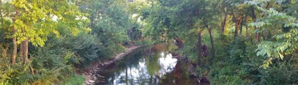
What could provide that unifying thread? The very same element that drew frontiersmen to this glorious spot of wilderness in the first place: Town Branch Creek.

Ever wonder why Lexington is located where it is? Why the city grid has no cardinal bearings? Why the central business district is so long and thin?

Believe it or not, Lexington was settled in 1779 along the banks of the middle fork of Elkhorn Creek, a small tributary called Town Branch that now lies buried under Vine Street.

What Town Branch Trail, Inc., a five-year-old 501-c-3 nonprofit, hopes Lexington can achieve is no less than the rebirth of the forgotten creek where our city was born at the dawn of the American Revolution. At its fullest, the project would take the form of a ten-foot-wide asphalt path shared by bicycles and pedestrians running a minimum of eight miles from downtown Lexington out to Masterson Station Park (which has an additional four-mile grass loop). Within the immediate downtown area, we envision a half-mile ribbon park running down Vine Street that would connect Thoroughbred and Triangle Parks (over the footprint of the buried creek). This Vine Street section of the trail would emulate the dry-stone canal and tree-lined “commons” that our city created out of the creek over 200 years ago. (We don’t propose digging up the actual buried stream.)

The scope and potential of this project can at first appear by degrees thrilling, daunting, or hopelessly far-fetched. Nonetheless, this project is slowly becoming a reality. A Downtown Master Plan commissioned by the Lexington Downtown Development Authority has integrated this project as a central element. Town Branch Trail is a major component of the city’s unanimously approved Greenway Masterplan. It has been integrated into the design for the Newtown Pike Extension, and Congressman Ben Chandler has offered enthusiastic support for the idea. To date, the project has attracted over $1,000,000 of in-kind donations of land and labor and $450,000 of funding to build two miles of trail. On October 8 at 10 a.m., we will dedicate the first half-mile of trail across from Masterson Station Park in the McConnell Trace neighborhood.

Now let’s put our efforts in context: The San Antonio Riverwalk took 40-plus years to create, and cities like Austin and Portland have been building miles of urban trails since the 1970s. These lovely places have been enjoying a very positive urban renaissance for decades as a result. Our situation is a bit like what Mark Twain said about Kentucky: “When judgement day comes, I’m moving to Kentucky, because everything happens there twenty years later.” Well, our twenty-year lag time is over, folks, and we have lots of nitty-gritty work ahead, but with equal measures of inspiration, perspiration, and cooperation we can carve a path into the future that will take Lexington to a whole new level of prosperity and urban life.

Let Lexington leaders know how you envision (Legacy) trail

Friday, Oct. 24, 2008 by Tom Eblen, Herald-Leader columnist in Bluegrass & Beyond: Tom Eblen’s blog

Something exciting is about to happen along the Newtown Pike corridor between downtown and the Kentucky Horse Park.

It will happen in nearby fields and just over the hills. Along Cane Run Creek. Up through the Lexmark campus and Coldstream Park, across the University of Kentucky’s Maine Chance Farm and past the Vulcan limestone quarry and Spindletop Farm.

In the 700 days left before the 2010 Alltech FEI World Equestrian Games, the city of Lexington will build a basic version of the Legacy Trail, a nine-mile bicycle and pedestrian path that is a key piece of the city’s Greenway Master Plan.

What will the Legacy Trail be? Planners see it as a human connection between urban and rural Lexington, a place for recreation, art and education. But they really want to know what you want the trail to be.
This week, a series of public meetings are being held with “stakeholders” — more than 300 nearby property owners, neighborhood groups, community and arts organizations.

Beginning at 8:45 a.m. Saturday, there will be a public event called “Party on the Trail” at Coldstream Park to start publicizing the route and to ask for suggestions about what amenities should be developed around it.
“It has got to be more than a ribbon of asphalt,” said Steve Austin, director of the Bluegrass Community Foundation’s Legacy Center. “It’s got to be a story about who we were, and what this place was and is. It’s a story about where we’re going to go and who we’re going to become in the 21st century.”

The idea of a trail from downtown to the Horse Park has been batted around for years. David Mohney, a UK architecture professor, had noted that much of the property between the two was in very few hands. The major landholders are Eastern State Hospital (soon to become the Bluegrass Community and Technical College campus), Lexmark, the University of Kentucky and Vulcan Materials.

Commerce Lexington’s 2007 trip to Boulder, Colo., showed local leaders how important bicycle and pedestrian trails could be to improving a community’s health and quality of life. Mayor Jim Newberry made the Legacy Trail a priority. Activist Marnie Holoubek, Urban County Councilman Jay McChord, UK Agriculture Dean Scott Smith and others started making things happen.

Keith Lovan of the city engineering department is overseeing the project. And its unofficial cheerleader is the Legacy Center, which is using money from the John S. and James L. Knight Foundation and other sources to see that the trail and an East End neighborhood revitalization project are accomplished as legacies of the 2010 Equestrian Games.

So far, more than $3 million has been raised to begin trail construction between the Horse Park and the intersection of Citation Boulevard and Newtown Pike. Initially, at least, much of the rest of the trail into town will run on existing pavement.

Austin took me on a tour of the route earlier this week. Several of us plan to ride it on bicycles before the party Saturday morning — if it isn’t raining too hard.

The Legacy Trail would begin downtown at Cheapside Park, go west on Second Street to Jefferson Street and north through what is now the Eastern State property to the Northside YMCA on Loudon Avenue.
Austin said planners are working with Lexmark on a formal agreement to have the trail go through its campus. “Lexmark has been a good partner so far,” he said.

Lexmark’s property holds one of two keys to the trail’s success: a private bridge that crosses New Circle Road. After crossing the bridge, the trail would run through Lexmark property along Cane Run Creek and other property near Newtown Pike to the intersection with Citation Boulevard.

Eventually, planners hope to connect the Legacy Trail to other trails and to the proposed Isaac Murphy Park in the East End neighborhood. McChord would like to see it go south from downtown, all the way through Jessamine County to the Kentucky River. To the west of downtown, Van Meter Pettit is planning the Town Branch Trail through the proposed Lexington Distillery District, another potential connection.

Linking Lexington’s urban and rural neighborhoods in ways that don’t require motor vehicles would be good for our health and sense of community. It also could help us and our visitors learn more about Lexington — and not just the usual history lessons from the 18th and 19th centuries.

More than 1,000 years ago, Fayette County was home to the Adena people, who left behind a huge mound of earth not far from the Horse Park. “Could we tell the story through landscape architecture and earthwork?” Austin wondered. “Could we tell the story of the pre-settlement environment — what trees and grasses were here?”

Austin also would like the trail to have kiosks explaining more recent history, such as how Lexmark’s forerunner, IBM, led an economic shift toward manufacturing in Lexington in the 1950s at the campus that gave the world Courier typeface and the Selectric typewriter ball.
Who knows what you might be able to learn about your city someday, simply by lacing up your shoes or climbing on a bicycle.

Reach Tom Eblen at (859) 231-1415 or 1-800-950-6397, Ext. 1415, or at teblen@herald-leader.com. Read and comment on his blog, The Bluegrass & Beyond, at Kentucky.com.

Happy trails- HIKING, BIKING OPPORTUNITIES A BIG DRAW FOR CITY

Published 04/20/2007 in the Lexington Herald-Leader by Jennifer Hewlett

For years, Lexington leaders have envisioned a system of interconnecting trails that would run throughout Fayette County, providing places for people to bike and hike — and possibly serving as a draw for tourists and others hoping to get an up-close look at the Bluegrass.

Those plans have generally been a path to nowhere.

But this might be the year when many Lexingtonians are able to start dusting off their bicycles and lacing up their sneakers.

Before the year is out, Lexington’s trail mileage should nearly double with the construction of 6.5 more miles of paved trail for bicycling, walking and other types of non-motorized use. The mileage, scattered throughout Fayette County in six planned trail sections, will bring the total number of trail miles in Fayette County to nearly 15.

And city leaders, who say Lexington lags behind other cities in recreational opportunities such as trails, plan to spend more money on trail-building next year. So far, there are plans to build 4 miles of trail in Fayette County in 2008. An additional 13.6 miles are on the drawing board.

Mayor Jim Newberry has proposed spending $2 million for trails in the next city budget. City officials say that local money could be parlayed into $10 million in new trails if used to match federal grants.

Newberry said the renewed focus on trail-building could bring a lot of benefits to Lexington.

“In addition to recreation, they are economic-development tools, they are paths to improved health and can even be alternative transportation,” he said this week as the city put the finishing touches on the first mile of the Brighton East Rail Trail. That route runs from Bryant Road to Pleasant Ridge Drive in southeastern Fayette County.

The mile-long section, which was paid for with $426,000 in federal funds and will be officially dedicated Sunday, is the first piece of trail built along an abandoned railroad corridor in Fayette County. The railroad abandonment runs from Lexington to just outside of Ashland.

“How can anybody not be for this?” said Lexington attorney Bill Gorton, who represents the Kentucky Rails to Trails Council, an organization that promotes turning abandoned railroad corridors into trails and greenways. “It is an absolute win-win for everybody, including neighbors.”

Trail sections to be built this year include:
• A second mile of the Brighton East Rail Trail, from Pleasant Ridge Drive to Deer Haven Lane, at a cost of $500,000.

• Town Branch Trail, 2 miles, from Long Branch Lane to Alexandria Drive, $550,000.

• South Elkhorn Trail, 1 mile, from Lockdale Terrace to Joseph Bryan Way, $200,000.

• Wellington Trail, a half-mile on Reynolds Road, from the traffic circle to the Shillito Park entrance, $150,000.

• Liberty Park Trail, a half-mile parallel to Flying Ebony Drive, $100,000.

• West Hickman Trail, a mile and a half, from Man o’ War Boulevard to Veterans Park, $1.5 million.

Construction is set to begin on the Liberty Park Trail section in the next couple of weeks. All of the trail projects planned for this year, which are being paid for with federal transportation dollars, should be complete before the end of the year, said Keith Lovan, a municipal engineer for the Lexington-Fayette Urban County Government who oversees local trail projects.

Trail proponents in Lexington point out that in other parts of the country, trails have led to an increase in tourism and the development of businesses along them, including bicycle shops and bed-and-breakfast inns.

“It actually increases the value of properties near or adjacent to these trails,” Gorton said. “The people that use them are generally the kind of people you would want in your neighborhood.”

Van Meter Pettit, who has been working for years to get a trail built that essentially follows Town Branch of Elkhorn Creek, sees that particular proposed trail as more than something that would lead to health and economic benefits. He sees it as a way of restoring “dormant” history.

Lexington got its start along Town Branch, part of which now runs under Vine Street and emerges west of Rupp Arena.

“What happened was, the city was just a village — it was laid out on a creek, and then it outgrew the creek, and they kind of covered it up, bit by bit,” said Pettit, who is president of Town Branch Trail Inc. “A good century and a half of the city developed along the regular course of the creek.”

A half-mile section of Town Branch Trail, from Leestown Road to Long Branch Lane, opened in October 2005.

There is opposition to certain trail legs proposed for Lexington. Some people who live near proposed trail segments are concerned about loss of privacy and vandalism, Lovan said.

“It has proven not to be the situation,” he said. “A lot of times our biggest opponents become our biggest supporters.”

Kentucky is behind many states when it comes to trails. But several other cities and towns in the state, including Louisville, Bowling Green and Owensboro, have made a commitment to building them. Louisville, especially, has a good trail program, Lovan said.

“We have a plan for a 100-mile loop, known right now as the Metro Loop,” said Metro Louisville transportation planner Mohammad Nouri. Nineteen miles of the loop, which will encircle Jefferson County, are already in place. Construction is to begin on 8 more miles this summer, he said.

He said Lexington ought to be commended for the trails it’s building.

Lexington leaders hope to eventually have two major trail arteries — one running north-south, from Veterans Park to the Kentucky Horse Park, and the other running east-west, from Masterson Station Park to Deer Haven Lane — to which neighborhood trailways would be connected. The exact routes for the north-south and east-west trails have not been determined, but three of the trail sections set to be built this year would be legs of the north-south and east-west trails, Lovan said.

“A lot of American cities have 20, 30, 60 miles of trails, and Lexington is one of those great American cities that is catching up,” Pettit said. “Louisville sets a very high benchmark for us, and it’s a good thing. If we set our sights on emulating Louisville, then we’ll have a world-class trail system in no time.”If you go

The first section of the Brighton East Rail Trail will be dedicated at 2 p.m. Sunday in Pleasant Ridge Park. The event will include bike and pony rides, popcorn and prizes.

Lexington is getting 6.5 miles of biking and walking trails this year. The trail sections to be constructed are scattered throughout Fayette County.

Published 04/20/2007 in the Lexington Herald-Leader by Jennifer Hewlett