 |
|||||||||||||||||||||||||||||||||||||||||||||
• What is Town Branch Trail? The
Town Branch Trail is a proposed greenway and trail, or linear park,
that will begin in downtown Lexington, following the Town Branch Creek
(where possible) as it flows west. The Town Branch Trail will link downtown
to a variety of recreational, historic and environmental resources;
provide alternate transportation routes from neighborhoods to downtown;
and improve the habitat and water quality of this historic stream, along
the banks of which the city of Lexington was founded. Download
and print our welcome brochure (1.5m pdf) that introduces Town Branch
Trail, offers a basic map of the trail, and gives a mail-in membership
and charitable giving form. • The Disappearance of Town Branch by Zina Merkin, November 2001 Many mid-western cities are laid out on a grid oriented to the four principal directions. Lexington's grid, and its designations of North Limestone and East Main Street are curiously askew from those compass directions. The city originally was oriented along the banks of the Middle Fork of the Elkhorn, also known as Town Fork or Town Branch. But this stream along which the town initially was laid out is now nowhere to be seen. This paper sets out to track the vanishing of Town Branch, the reasons for its disappearance, and its influence on the development of the city of Lexington, linking this particular history with issues in the settlement and development of the United States in general. While the stream in the earliest years may have been a pretty little creek, it quickly took on an urban character. Water supply was derived from springs, and later, wells, while the creek supported early industry. Tracking the fortunes of Town Branch offers an interesting window on the development of various kinds of urban infrastructure, and a reflection of Lexington's growth, its changing economic base, and local effects of landscape changes occurring on a national level. Click this link to open the "The Disappearance of Town Branch" in PDF format (100 kilobytes). • Town Branch Greenway: Constructing the Vision....Connecting the Dots The following report summarizes a joint proposal for the future design and development of the Town Branch Greenway in Lexington, Kentucky. Its content includes an analysis of existing conditions, opportunities and constraints identified, issues and concerns raised in public discussions, as well as design proposals and land-use recommendations. This study was
a planned collaborative effort between the Department of Landscape Architecture
at the University of Kentucky and Friends of the Parks of Fayette County,
Inc (the latter acted as the lead organization). Much information, support,
and assistance for this project was provided by the Lexington-Fayette
Urban County Government. Funding for the charrette was awarded to the
Friends of the Parks by the Kodak American Greenways Program. Several
design professionals from the local community also volunteered their
time and effort during the two-day charrette that took place in mid-February • The Town Branch Environment: An Initial Evaluation In 2001, the Environmental Quality Committee of Town Branch Trail collected information about the condition of the environment of Town Branch. Our findings and conclusions are presented in an 18-page illustrated report: "The Town Branch Environment: An Initial Evaluation." Among the report's recommendations are trash cleanup, extensive streamside zones of native trees and other plants, public education, partnerships with other environmental organizations, and technical consultations on stream morphology and water quality issues. Click this link to open the "The Town Branch Environment" in PDF format (2.4 megabytes). • What is a Greenway? "Greenways are corridors of protected open space managed for conservation and recreation purposes. Greenways often follow natural land or water features, and link nature reserves, parks, cultural features and historic sites with each other and with populated areas. Greenways can be publicly or privately owned and some are the result of public/private partnerships. Trails are paths used for walking, bicycling, horseback riding or other forms of recreation or transportation. Some greenways include trails while others do not." -from the Trails and Greenways Clearinghouse www.trailsandgreenways.org |
|||||||||||||||||||||||||||||||||||||||||||||
 |
|||||||||||||||||||||||||||||||||||||||||||||

 |
|
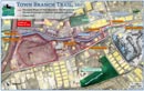
• Proposed
Trail, 2008 Interactive Map
|
 |
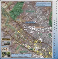
• Proposed
Phase III, 2007 Town
Branch Phase III
|
 |
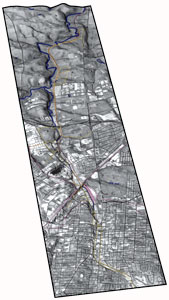
• Town Branch Trail Guide Town
Branch Trail Guide
|
|
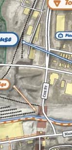
| • Our Trail Plan We offer the trail plan in numerous formats for on-screen viewing and printing. Detailed Trail Alignment Map A fine-detail color map for print • 1.2m color jpg image • 1.5m pdf • 4.5m complete map pdf • 4.4m Flash™ map browser Summary of Trail Alignment The map from our newsletter viewable without plug-ins. • 250k b&w jpg image A Photograpic Tour of the Trail A photo gallery of destinations from complete trail plan pdf Newtown
Pike Extended |
 |
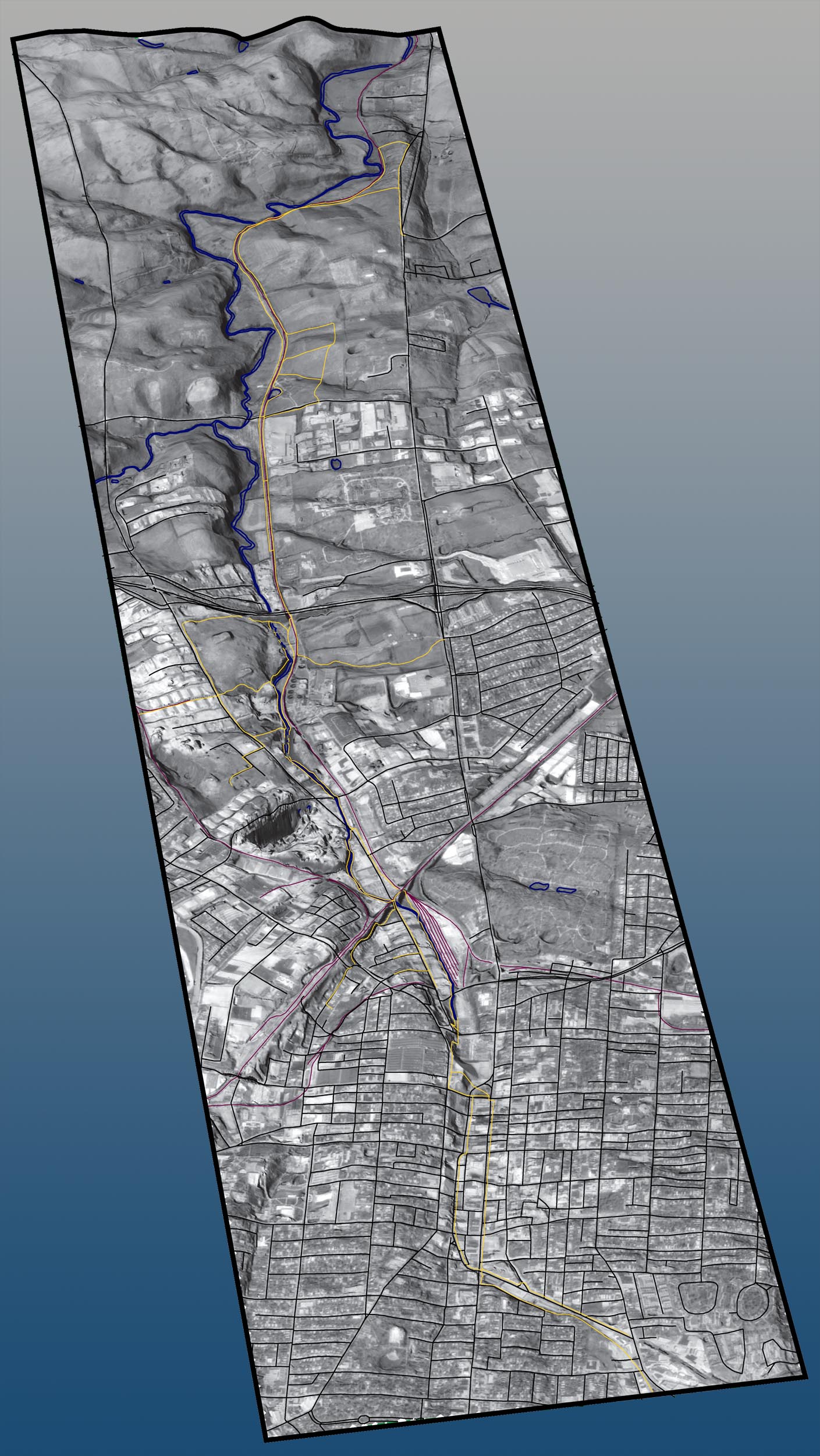
| •Help
us create our 3D Map This is a draft visualization. If you would like to make this map better, then contact Boyd at boyd@townbranch.org Large Graphic ( .jpg image: 450k) Small Graphic ( .jpg image: 150k) *Yellow is Trail, Blue is Water, Pink is Railroad, and Black is Road. |
 |
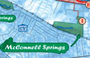
| •
Locate Town Branch Creek easily on this regional map of the Central Bluegrass. (GIF 40K) |
 |
 |
|
| • Town Branch flows into the South Elkhorn and then meets the Kentucky River at Frankfort. (GIF: 70K) | 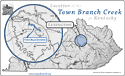 |
| •Historic
Maps of Lexington
|
|
| • 1871 Bird's Eye View of Lexington (1.5M PDF) | 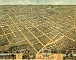 |
| • 1833 Map of Lexington (300K PDF) | 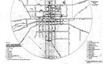 |
| • 1855 Map of Lexington (300K PDF) |  |
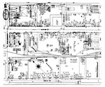
•
1886 Sanborn Maps of Lexington (300k each) |
 |
| • 1771 Filson Map of Kentucky (350K PDF) | 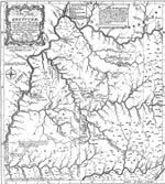 |
| • 1775 British America (1.5M PDF) | 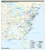 |
|
|